
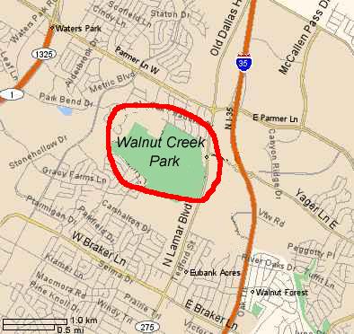
Walnut creek is in north Austin. The entrance is on Lamar Blvd.
From 35 go west on Braker Lane and Turn north on Lamar Blvd.
Park where indicated on this map: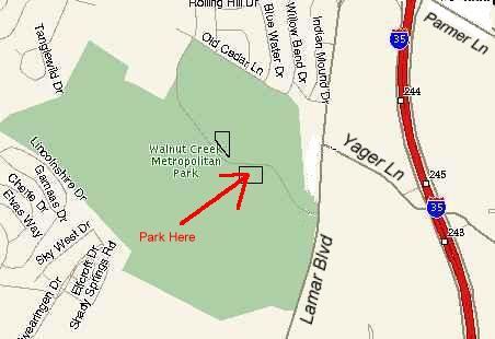
GPS coordinates of where we park: N30° 24.048 W97° 41.033 (WGS84)
Here's a
trail-map of the park.
link is broke: Here's an "http://home.austin.rr.com/jjaimes/Walnut%20Creek.jpg" aerial photo of the park
with trails overlayed.
Back to Muni Page